Alaska

Read More

Working to Alleviate Alaska’s Avgas Anxiety

AACA Testifies to the Alaska House Transportation Committee

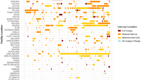
The Executive Director of the AACA, Will Day, collaborated with Troy LaRue, Director of Alaska’s Statewide Aviation Division of the DOT, Dan Knesek from Grant Aviation, and Dr. Mike Jones of UAA’s Institute of Social and Economic Research. Together, they informed Alaska’s House Transportation Committee about the effects of unreliable AWOS and ASOS systems throughout the state.
Read More

Research on school finance, the teacher workforce, and related topics in Alaska

This is a list of recent publications and reports by CAEPR and ISER focused on school finance, teacher workforce issues (recruitment, retention, and turnover),and related topics. This represents only a small portion of the education-related products from CAEPR and ISER. All CAEPR/ISER reports are available on the web at Scholarworks@UA, and you can see many of our peer-reviewed journal publications on journal websites or via the UAA/APU Consortium Library.

Read More

Spatial distribution of wildfire threat in the far north: exposure assessment in boreal communities

Increased wildfire activity has raised concerns among communities about how to assess and prepare for this threat. There is a need for wildfire hazard assessment approaches that capture local variability to inform decisions, produce results understood by the public, and are updatable in a timely manner. In this article, Schmidt and her co-authors describe how, in partnership with wildfire practitioners and communities, they created a tool that rapidly assesses wildfire hazards and is easily modified to help identify and prioritize mitigation activities.

Read More

Predicting the Unpredictable: Predicting Landcover in Boreal Alaska and the Yukon Including Succession and Wildfire Potential

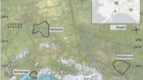
In this paper we modified an existing landcover dataset to better identify vegetation associated with wildfire and permafrost in Fairbanks, Anchorage, and Whitehorse over the past 4 decades (1984-2014) and make predictions for the next 4 decades (2024-2054).  We used an existing fire model called FlamMap and several statistical analyses to determine where future fires could be possible.